Dinorwig slate quarry, in northwest Wales, is an awe-inspiring site. Huge pits carved out of the mountain and spoil heaps rippling down the hillside, with open views across Lake Peris to the Snowdon range.
Humans started farming the area about 3,000 years after glaciers retreated at the end of the last Ice Age, but it is slate quarrying which put Dinorwig on the map. Commercial extraction started in 1787 and ended in 1969, when the quarry closed. It now lies abandoned, a vast expanse of mineral bleakness, with patches of vegetation. But the memory of the quarrymen still defines the identity of the valley.
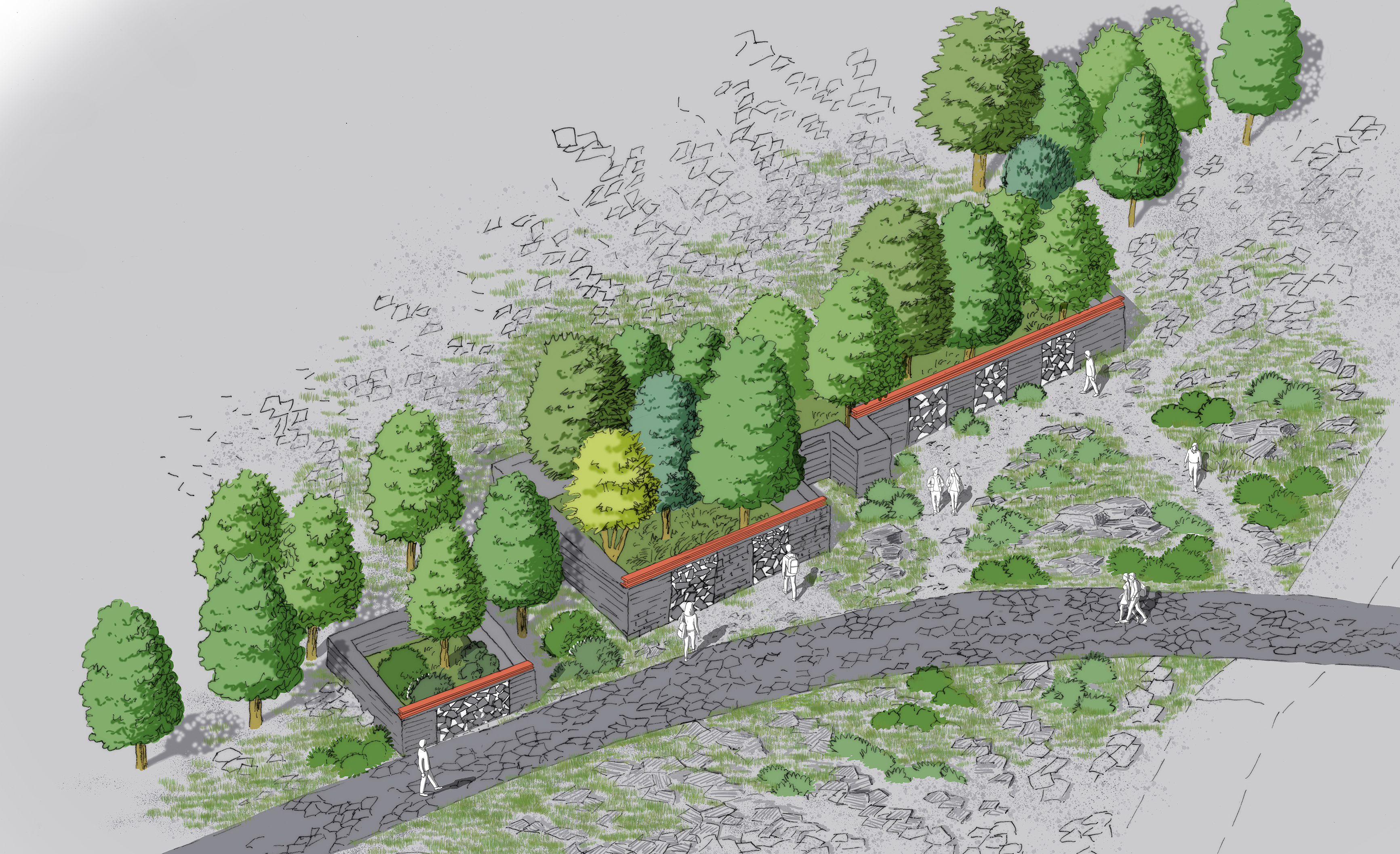
How can we hold on to these memories while shaping a distinctive future for the site? This is what the Cabans of reconciliation project is about: reactivating features such as the quarrymen’s cabans as metaphors for their past activities, and turning them into vessels for the revegetation of the quarry against the backdrop of climate change. Having sheltered quarrymen over generations, the cabans and other buildings will now shelter trees and plants which will then be allowed to self-seed and spread further around the site.

A cluster of mills and sheds around one of the two main inclines at the quarry, the A incline, will be returned to use as the main focus to experiment and kick-start the revegetation process.
A-incline structures
The Evolution Mill, housed in the only large building left standing, will tell the story of the site itself, taking visitors from post-glacial times through a patch of Celtic rainforest, and from the farmed landscape through to quarrying times.



Around the corner from the Evolution Mill will be the site’s Plant Nursery, located in a former shed, of which there is nothing left other than collapsed walls. Locally sourced saplings and shrubs will be grown there before being planted out in one of the cabans or buildings around the site.
The nursery will be open to visitors as part of the Dinorwig experience and will be run partly by local community groups and schools interested in the project. Entrance will be over broad cattle grid bridges, to prevent wild goats from entering.


Across the main track from the nursery used to be a long packing shed, which will be revived as a Podium Lab. Set over three levels, the podium will be a place to pause and take in the views over to Mount Snowdon (Yr Wyddfa) in the shade of climate-resilient trees. Because the area will be in open access, the plants chosen were selected on the basis that they are unpalatable to grazing animals.
Slate was carried in and out of the packing shed by rail on narrow-gauge rail tracks which were sold when the quarry closed in 1969. These will be brought back as paths connecting the podium to the plant nursery and the fourth building in the A-incline cluster, the Future Forest Mill. The main rail tracks which ran all the way from the fourth building, through the Podium Lab and to the nursery will be resurrected as a rill.
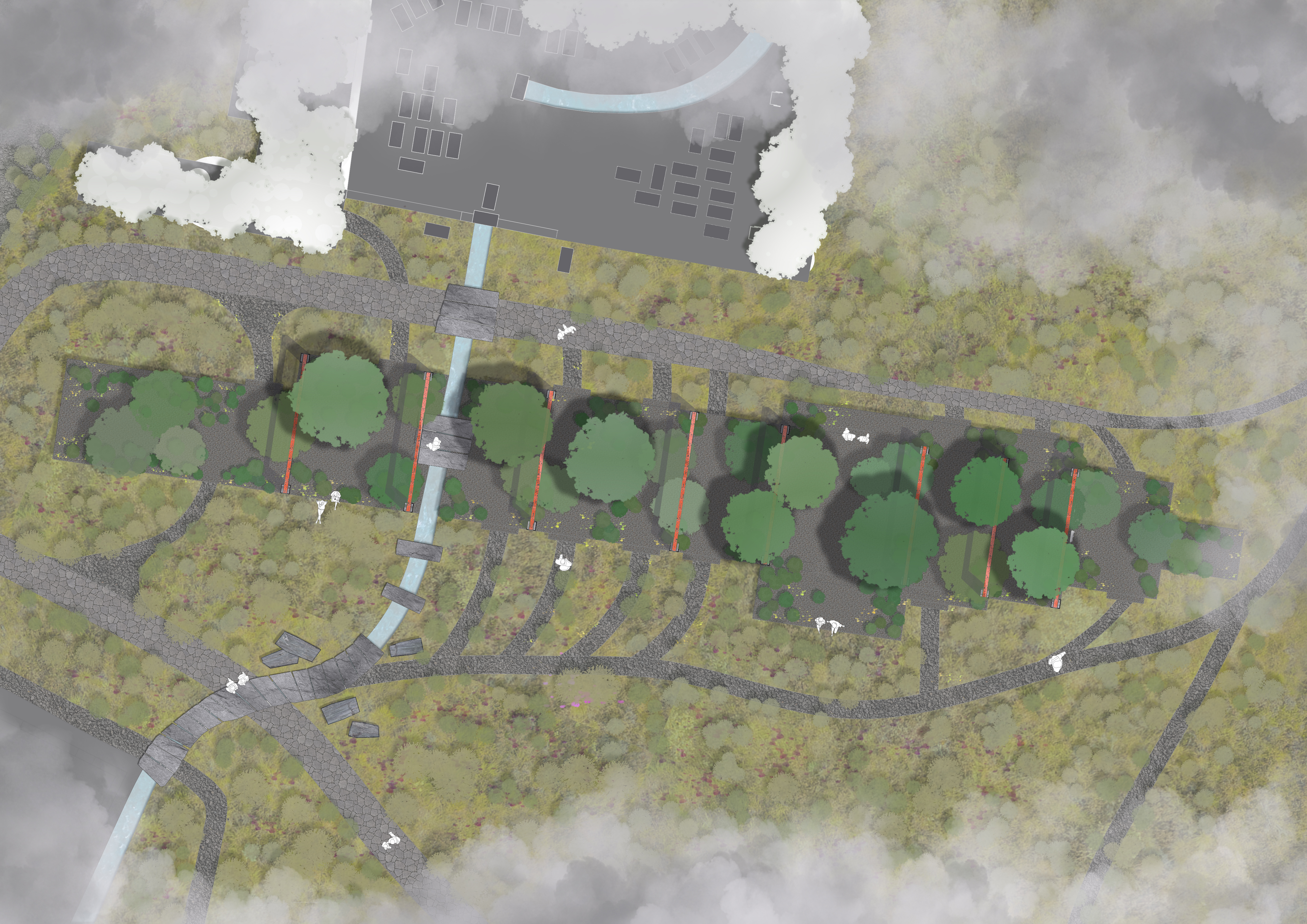


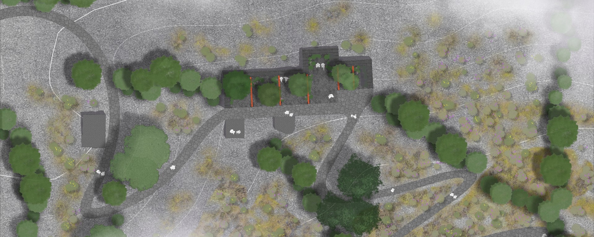
The fourth feature of the A-incline cluster will be the Future Forest Mill, on the site of a former sawing and packing mill around a courtyard where the slate would have been loaded onto rail carriage before being taken down the hill to the quarry’s train station.
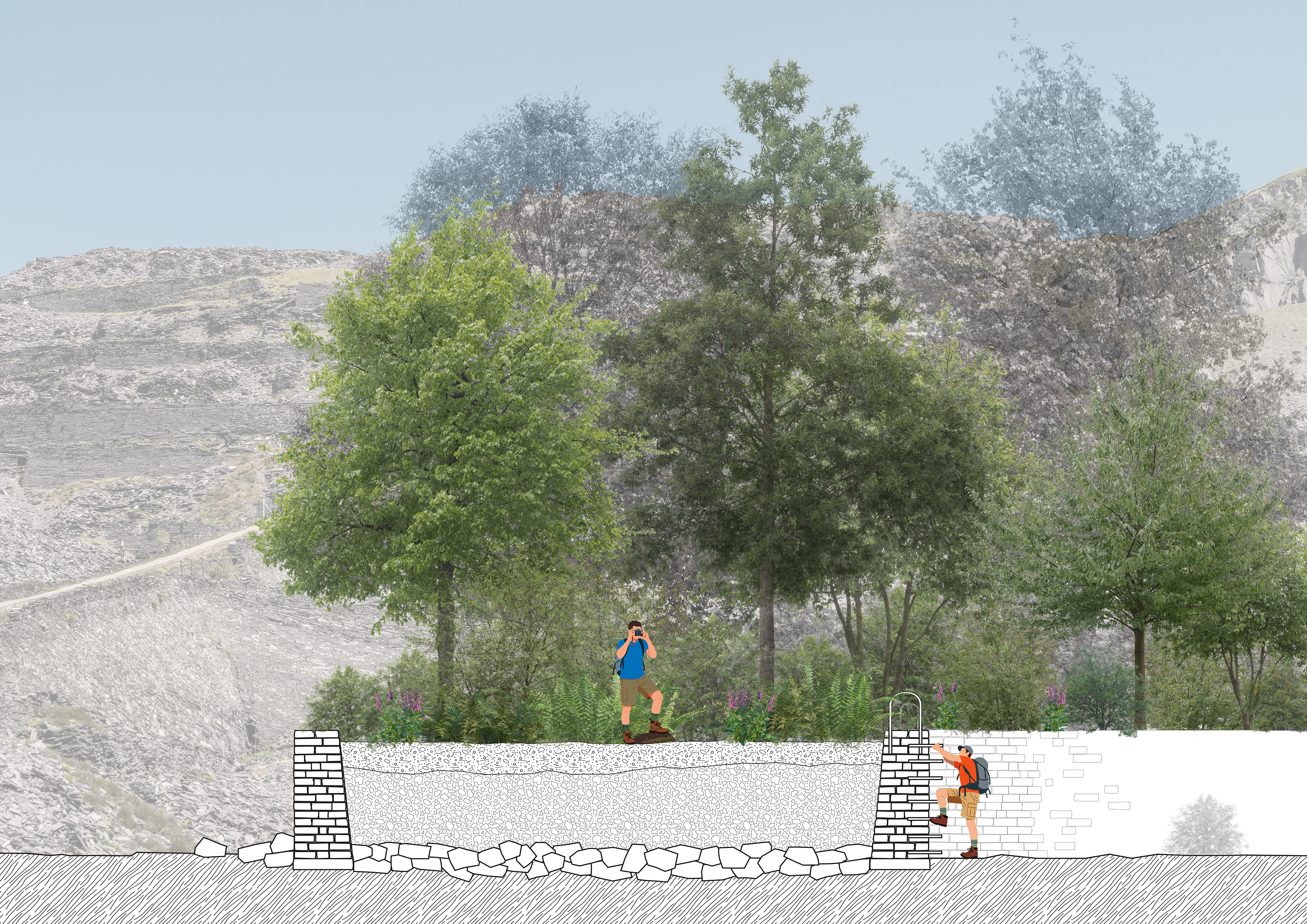
The U-shaped footprint of the building will be rebuilt as an elevated forest 2m above the ground, protecting the trees from feral goats. It will be accessible to visitors via ‘swimming pool’ ladders.
Careg-wen-uchaf



As visitors continue down the main track, they end up above Llyn Peris at a farmstead once known as Careg-wen-uchaf (‘Great white rock’). The farm and its outbuildings were swallowed up by the advancing quarry and they ended up being buried under slate waste just before the First World War. The Cabans project proposes to bring it back as a structure where visitors will be able to shelter and admire the glacial valley landscape.
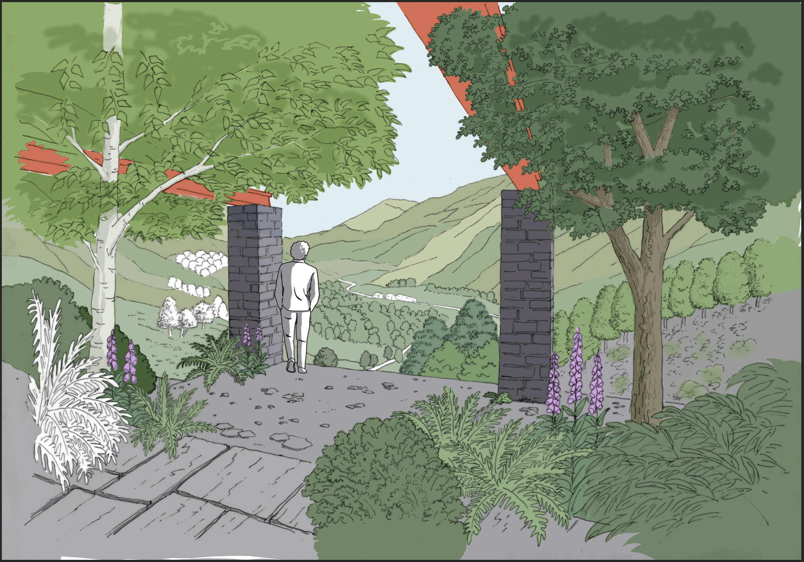
Working with an 1886 Ordnance Survey map showing the area when it was still a working farm integrated into its wider agricultural landscape, we are bringing back vegetation following indications on the map: groups of conifers, small groves of broadleafs, and rows of trees to mark the paths which got buried and earlier field boundaries.


Cabans and other structures
Cabans and other buildings dotted around the quarry will be restored and developed following the same approach. It is hoped that some will be taken on as community projects by local schools and societies.
///

